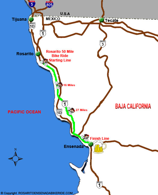
Rosarito Ensenada 50 Mile Fun Bicycle Ride takes you on a 50 mile journey along the Pacific Coast of Baja and inland through rural countryside. The race begins in Rosarito Beach and ends in Ensenada. There are many stops along the way if you get tired, and there is always a huge party at the finish line in Ensenada. The map below shows you the starting and finishing points of the Rosarito Ensenada Bike Ride. Even though the map does not show it between mile 24 and 27 there is a huge hill called El Tigre. El Tigre starts at almost sea level and climbs to over 800 feet. This will be the most challenging part of the entire bike race. If you decide to walk up this hill, dont be embarrassed because you will not be alone. After El Tigre it is all downhill until you coast into Ensenada for an all night party.
See Also: Starting Line Directions